Index of /app/uploads/2025/12
Name
Last modified
Size
Description
Parent Directory
-
plan_Corny.jpg
2025-12-09 14:51
100K
plan_Corny-300x300.jpg
2025-12-09 14:51
20K
plan_Corny-150x150.jpg
2025-12-09 14:51
6.3K
image0000011.jpg
2025-12-18 14:44
104K
image0000011-1152x1536.jpg
2025-12-18 14:44
108K
image0000011-768x1024.jpg
2025-12-18 14:44
56K
image0000011-225x300.jpg
2025-12-18 14:44
7.0K
image0000011-150x150.jpg
2025-12-18 14:44
3.3K
formulaire-dossier-candidature.pdf
2025-12-03 10:11
406K
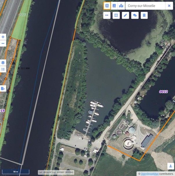
capture-site.jpg
2026-01-21 16:24
78K
capture-site-1024x393.jpg
2026-01-21 16:24
61K
capture-site-768x295.jpg
2026-01-21 16:24
40K
capture-site-300x115.jpg
2026-01-21 16:24
9.8K
capture-site-150x150.jpg
2026-01-21 16:24
7.3K
Terrain-et-ponton-JOINVILLE.pdf
2025-12-12 09:47
384K
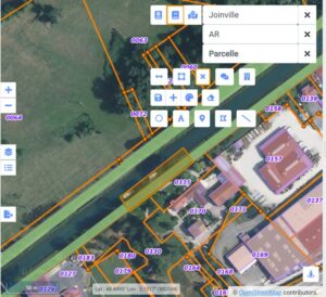
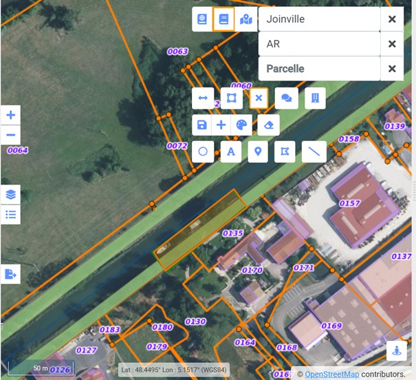
Plan_joinville.jpg
2025-12-12 09:35
114K
Plan_joinville-300x274.jpg
2025-12-12 09:35
25K
Plan_joinville-150x150.jpg
2025-12-12 09:35
7.8K
Plan_joinville-1.jpg
2025-12-12 09:47
114K
Plan_joinville-1-300x274.jpg
2025-12-12 09:47
25K
Plan_joinville-1-150x150.jpg
2025-12-12 09:47
7.8K
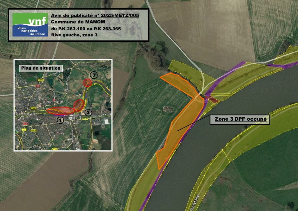
Plan_MEC_EARL-KANDEL_Zone3.jpg
2025-12-05 14:33
295K
Plan_MEC_EARL-KANDEL_Zone3-1024x724.jpg
2025-12-05 14:33
134K
Plan_MEC_EARL-KANDEL_Zone3-768x543.jpg
2025-12-05 14:33
78K
Plan_MEC_EARL-KANDEL_Zone3-300x212.jpg
2025-12-05 14:33
14K
Plan_MEC_EARL-KANDEL_Zone3-150x150.jpg
2025-12-05 14:33
5.9K
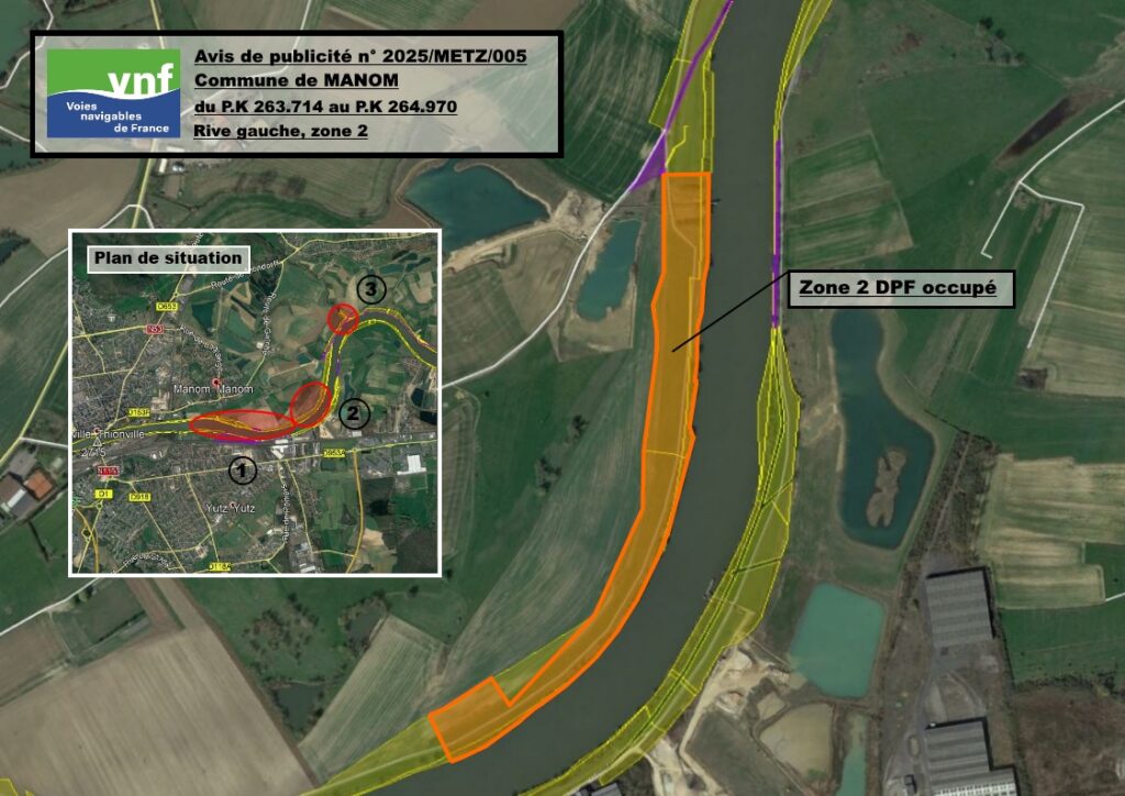
Plan_MEC_EARL-KANDEL_Zone2.jpg
2025-12-05 14:33
291K
Plan_MEC_EARL-KANDEL_Zone2-1024x724.jpg
2025-12-05 14:33
129K
Plan_MEC_EARL-KANDEL_Zone2-768x543.jpg
2025-12-05 14:33
80K
Plan_MEC_EARL-KANDEL_Zone2-300x212.jpg
2025-12-05 14:33
16K
Plan_MEC_EARL-KANDEL_Zone2-150x150.jpg
2025-12-05 14:33
6.4K
Plan_MEC_EARL-KANDEL_Zone1.jpg
2025-12-05 14:32
379K
Plan_MEC_EARL-KANDEL_Zone1-1024x724.jpg
2025-12-05 14:32
178K
Plan_MEC_EARL-KANDEL_Zone1-768x543.jpg
2025-12-05 14:32
107K
Plan_MEC_EARL-KANDEL_Zone1-300x212.jpg
2025-12-05 14:32
19K
Plan_MEC_EARL-KANDEL_Zone1-150x150.jpg
2025-12-05 14:32
7.4K
Plan-situation.png
2025-12-15 10:21
177K
Plan-situation-300x166.png
2025-12-15 10:21
40K
Plan-situation-150x150.png
2025-12-15 10:21
18K
Plan-de-situation.png
2025-12-02 14:55
498K
Plan-de-situation-300x219.png
2025-12-02 14:55
95K
Plan-de-situation-150x150.png
2025-12-02 14:55
35K
Photo2.png
2025-12-02 14:58
619K
Photo2-300x165.png
2025-12-02 14:58
106K
Photo2-150x150.png
2025-12-02 14:58
49K
Photo.png
2025-12-15 10:08
660K
Photo-300x166.png
2025-12-15 10:08
105K
Photo-150x150.png
2025-12-15 10:08
45K
PORT-LA-MALADIERE.pdf
2025-12-01 09:59
247K
Formulaire_DECLARATION_candidature_SAONE.docx
2025-12-04 15:45
269K
Export_carte_Warneton_-_Terrain_agricole.pdf
2025-12-04 11:00
432K
Export_carte_Warneton_-_Terrain_agricole-1.pdf
2025-12-12 08:26
468K
Export_carte_Serques_-_Terrain_agricole.pdf
2025-12-04 09:50
397K
Export_carte_Houplin-Ancoisne_-_Terrain_agricole-.pdf
2025-12-03 12:10
450K
Export_carte_Deulemont_-_Terrain_agricole.pdf
2025-12-03 11:09
424K
Export_carte_Chateau-l_Abbaye_-_Terrain_agricole.pdf
2025-12-04 10:18
364K
Export_carte_Bruille-Saint-Amand_-_Terrain_agricole.pdf
2025-12-04 10:18
415K
Emplacement_BRIARE_Quai-du-Baraban.pdf
2025-12-18 11:21
324K
Emplacement.png
2025-12-15 10:21
477K
Emplacement-300x166.png
2025-12-15 10:21
95K
Emplacement-150x150.png
2025-12-15 10:21
45K
CdC.pdf
2025-12-15 10:21
479K
Cahier-des-charges.pdf
2025-12-03 11:41
787K
Base_fluviale_Chaumont.jpg
2025-12-01 09:50
98K
Base_fluviale_Chaumont-300x279.jpg
2025-12-01 09:50
21K
Base_fluviale_Chaumont-150x150.jpg
2025-12-01 09:50
7.0K
Base_fluviale_Chaumont-1.jpg
2025-12-01 10:04
100K
Base_fluviale_Chaumont-1-300x273.jpg
2025-12-01 10:04
22K
Base_fluviale_Chaumont-1-150x150.jpg
2025-12-01 10:04
7.2K
Annexe-6-Note-espaces-verts.pdf
2025-12-03 11:44
201K
Annexe-5-Modele-cot-vierge.pdf
2025-12-03 11:43
504K
Annexe-4-Cadre-financier.xlsx
2025-12-03 11:43
35K
Annexe-3-Cadre-candidature.pdf
2025-12-03 11:42
137K
Annexe-2-Bati-et-espaces-confies.pdf
2025-12-03 11:42
1.3M
Annexe-1-Plan-de-situation.pdf
2025-12-03 11:42
316K
20251217_144853.jpg
2025-12-18 14:37
1.8M
20251217_144853-scaled.jpg
2025-12-18 14:37
1.0M
20251217_144853-2048x1536.jpg
2025-12-18 14:37
712K
20251217_144853-1536x1152.jpg
2025-12-18 14:37
464K
20251217_144853-1024x768.jpg
2025-12-18 14:37
254K
20251217_144853-768x576.jpg
2025-12-18 14:37
169K
20251217_144853-300x225.jpg
2025-12-18 14:37
70K
20251217_144853-150x150.jpg
2025-12-18 14:37
57K
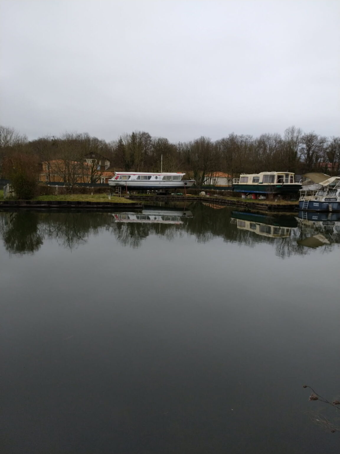
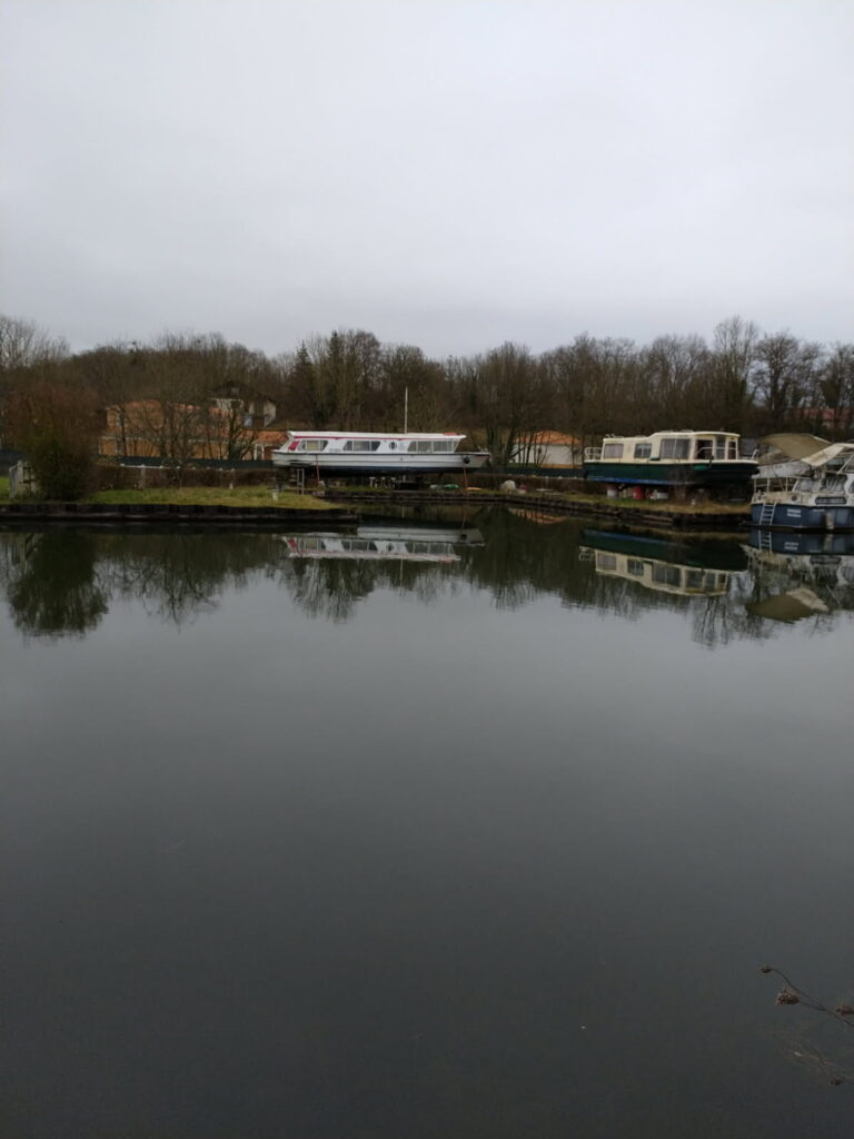
20251006_100901.jpg
2026-01-26 14:01
8.0M
20251006_100901-scaled.jpg
2026-01-26 14:01
1.2M
20251006_100901-2048x1536.jpg
2026-01-26 14:01
853K
20251006_100901-1536x1152.jpg
2026-01-26 14:01
532K
20251006_100901-1024x768.jpg
2026-01-26 14:01
258K
20251006_100901-768x576.jpg
2026-01-26 14:01
149K
20251006_100901-300x225.jpg
2026-01-26 14:01
23K
20251006_100901-150x150.jpg
2026-01-26 14:01
8.2K
2025SaintDizier004_ponton_terrain_joinville.pdf
2025-12-12 09:47
1.0M
2025SD003_Base_fluviale_Chaumont.pdf
2025-12-01 09:59
821K
2025SD003_Base_fluviale_Chaumont-1.pdf
2025-12-01 10:51
823K
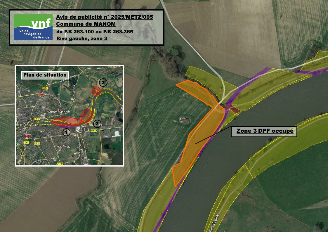
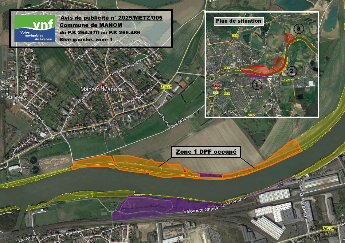
2025Metz005_Terrain_agricole_Manom.pdf
2025-12-05 14:31
385K
Apache/2.4.65 (Debian) Server at domaine-public-fluvial.vnf.fr Port 80